-40%
146 maps IOWA ghost towns STATE history atlas antique TREASURE HUNTING old DVD
$ 3.16
- Description
- Size Guide
Description
Your browser does not support JavaScript. To view this page, enable JavaScript if it is disabled or upgrade your browser.Click Here. Double your traffic. Get Vendio Gallery - Now FREE!
Rare Map Collection
This DVD is part of our Historic Map and Atlas Collection.
We have dozens of Atlas maps on DVD and CD ranging from the 1500s to the 1900s covering many areas and topics.
Please Check our Ebay Store for what's available.
FOR MANY MORE EDUCATIONAL CD TITLES
ON THIS AND MANY OTHER SUBJECTS
PLEASE VISIT OUR EBAY STORE
VERY LARGE HIGH RESOLUTION
MAP COLLECTION
ON DVD!!
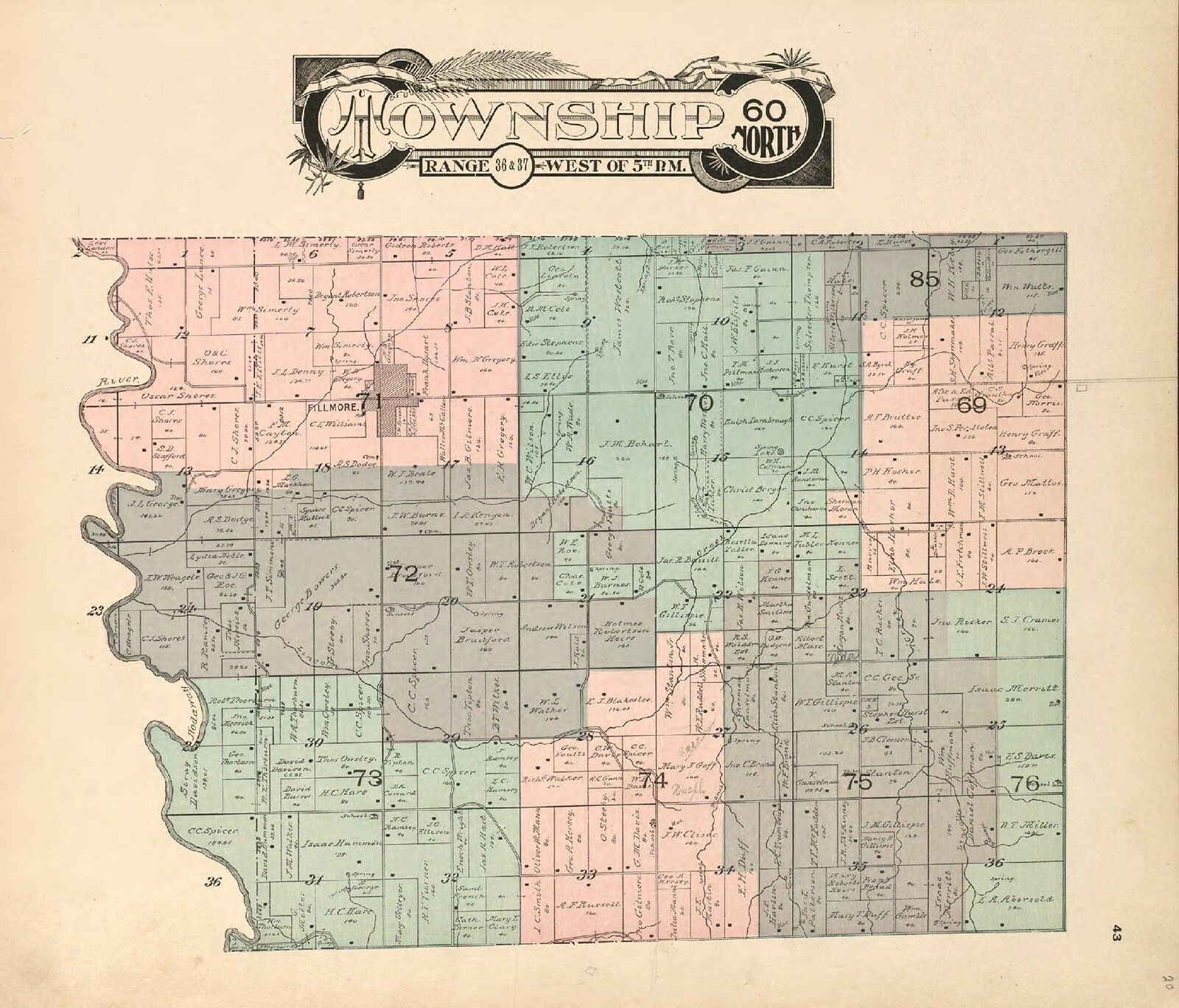
(please see full table of contents and sample illustrations below)
This DVD Contains
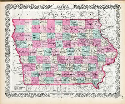
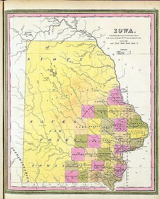
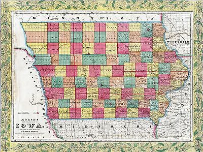
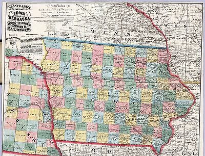
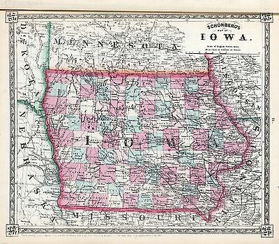
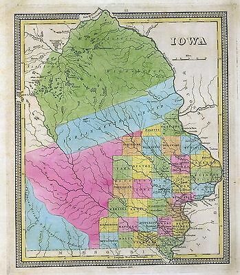
146 Maps of
Iowa
Including
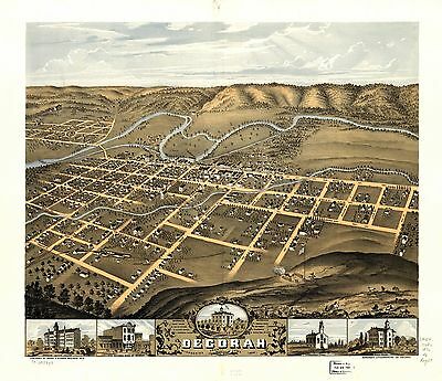
26 PANORAMIC MAPS
of various Iowa Cities
These are scans of the
ORIGINAL
maps by various Cartographers.
on DVD
System requirements
PC or Mac compatible.
Files are simple PDF files with a basic HTML interface (just like viewing a webpage)
Works with ALL versions of Windows.
Iowa
Map Collection
0018001
Davenport, Iowa, as seen from south west.
Andreas, A. T. (Alfred Theodore),
1875
0018005
Geological map of the State of Iowa, Climatological map of the State of Iowa.
Andreas, A. T. (Alfred Theodore),
1875
0018008
Maps of the State of Iowa showing representative districts, senatorial districts.
Andreas, A. T. (Alfred Theodore),
1875
0018009
Maps of the State of Iowa showing congressional districts, judicial districts.
Andreas, A. T. (Alfred Theodore),
1875
0018015
Sectional map of Iowa.
Andreas, A. T. (Alfred Theodore),
1875
0018020
Map of Allamakee County, State of Iowa.
Andreas, A. T. (Alfred Theodore),
1875
0089037
Iowa and Wisconsin.
Bradford, Thomas G
1838
0586035
Iowa, Missouri.
Mitchell, Samuel Augustus
1880
0594037
Iowa, Missouri.
Mitchell, Samuel Augustus
1890
1070007
Iowa.
U.S. General Land Office
1866
2301015
Iowa, Wisconsin
.Morse, Sidney E. (Sidney Edwards); Breese, Samuel ; Nicollet, J. N. (Joseph Nicolas)
1845
2483032
Iowa, Missouri.
Mitchell, Samuel Augustus
1870
2743008
Iowa, Missouri u. Illinois.
Lange, Henry
1854
2905027
Iowa And Nebraska.
Johnson, A.J.
1860
3565125
Iowa.
Rand McNally and Company
1897
3944001
Iowa.
Judson, L.
1838
4453039
Iowa and Wisconsin.
Goodrich, S.G. ; Bradford, Thomas G.
1841
5451000
State of Iowa.
U.S. General Land Office
1878
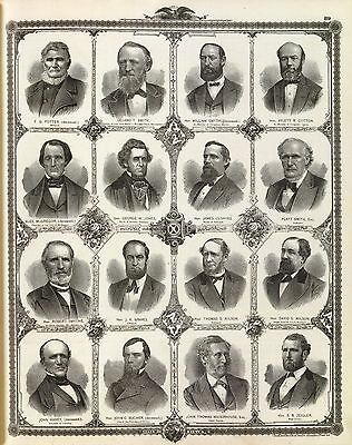
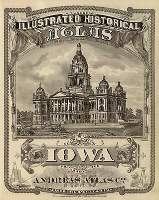
pm002051
Andreas, A. T. (Alfred Theodore), 1839-1900.
A. T. Andreas’ illustrated historical atlas of the State of Iowa.
1875
pm002060
Ruger, A.
Bird’s eye view of Blairstown, Benton Co., Iowa 1868. Drawn by A. Ruger.
1868
pm002070
Wellge, H. (Henry)
1889 perspective map of the city of Burlington, Ia. H. Wellge, sk.
1889
pm002080
Ruger, A.
Birds eye view of the city of Cedar Rapids and Kingston, Linn Co., Iowa 1868. Drawn by A. Ruger.
1868
pm002082
Andreas, A. T. (Alfred Theodore), 1839-1900.
A. T. Andreas’ illustrated historical atlas of the State of Iowa.
1875
pm002090
Ruger, A.
Bird’s eye view of the city of Council Bluffs, Pottawattamie Co., Iowa 1868. Drawn by A. Ruger.
1868
pm002091
Andreas, A. T. (Alfred Theodore), 1839-1900.
A. T. Andreas’ illustrated historical atlas of the State of Iowa.
1875
pm002092
Andreas, A. T. (Alfred Theodore), 1839-1900.
A. T. Andreas’ illustrated historical atlas of the State of Iowa.
1875
pm002100
Wellge, H. (Henry)
Davenport, Ia. 1888. H. Wellge, des.
[1888]
pm002110
Ruger, A.
Decorah, Winneshiek County, Iowa 1870. Merchants Lithographing Co.
[1870]
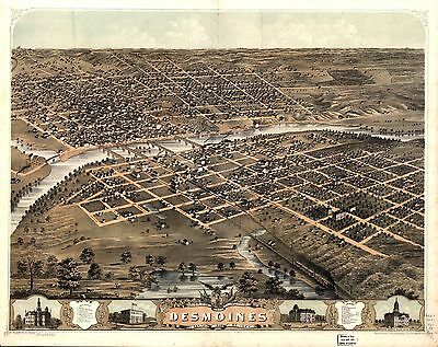
pm002120
Ruger, A.
Bird’s eye view of the city of Des Moines, the capital of Iowa 1868. Drawn by A. Ruger.
Chicago, Merchants Lithographing Co. [1868]
pm002121
Andreas, A. T. (Alfred Theodore), 1839-1900.
A. T. Andreas’ illustrated historical atlas of the State of Iowa.
[Chicago, Andreas Atlas Co.] 1875
pm002130
Ruger, A.
Birds eye view of the city of De Witt, Clinton Co., Iowa 1868.
[n.p., 1868]
pm002140
Wellge, H. (Henry)
Perspective map of the city of Dubuque, Ia. 1889. H. Wellge, sk.
Milwaukee, American Publishing Co. [1889]
pm002150
Wellge, H. (Henry)
Perspective map of Fort Madison, Ia. 1889. H. Wellge, sk.
Milwaukee, American Publishing Co. [1889]
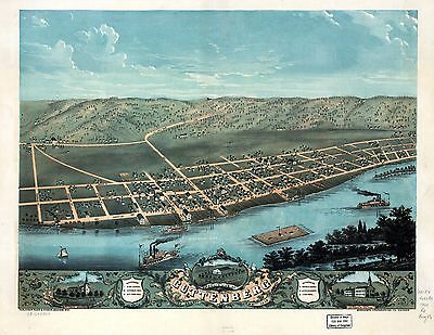
pm002160
Ruger, A.
Bird’s eye view of Guttenberg, Clayton County, Iowa 1869. Merchants Lithographing Co.
Madison, Wis., Ruger & Stoner [1869]
pm002170
Ruger, A.
Bird’s eye view of Iowa City, Johnson Co., Iowa 1868. Drawn by A. Ruger.
[Chicago] Chicago Lith. Co. [1868]
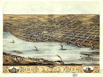
pm002180
Ruger, A.
Bird’s eye view of the city of Lyons, Clinton Co., Iowa 1868. Drawn by A. Ruger.
Chicago, Merchants Lithographing Co. [1868]
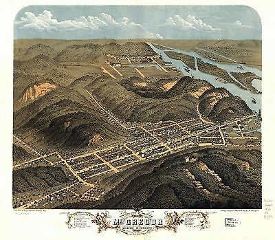
pm002190
Ruger, A.
Bird’s eye view of the city of McGregor and North McGregor, Clayton County, Iowa 1869. Chicago Lithog. Co.
Madison, Wis., Ruger & Stoner [1869]
pm002200
Ruger, A.
Bird’s eye view of the city of Marengo, Iowa Co., Iowa 1868. Drawn by A. Ruger.
Chicago, Merchants Lithographing Co. [1868]
pm002210
Ruger, A.
Bird’s eye view of the city of Marion, Linn Co., Iowa 1868. Drawn by A. Ruger.
Chicago, Merchant’s Lithographing Co. [1868]
pm002220
Ruger, A.
Bird’s eye view of the city of Marshalltown, Marshall Co., Iowa 1868.
[n.p., 1868]
pm002230
Ruger, A.
Bird’s eye view of the city of Montana, Boone Co., Iowa 1868. Drawn by A. Ruger.
Chicago, Chicago Lithographing Co. [1868]
pm002231
Andreas, A. T. (Alfred Theodore), 1839-1900.
A. T. Andreas’ illustrated historical atlas of the State of Iowa.
[Chicago, Andreas Atlas Co.] 1875.
pm002240
Ruger, A.
Bird’s eye view of Newton, Jasper Co., Iowa 1868. Drawn by A. Ruger.
Chicago, Merchant’s Lithographing Co. [1868]
pm002241
Andreas, A. T. (Alfred Theodore), 1839-1900.
A. T. Andreas’ illustrated historical atlas of the State of Iowa.
[Chicago, Andreas Atlas Co.] 1875
pm002250
Wellge, H. (Henry)
Perspective map of Sioux City, Iowa. 1888. Henry Wellge, sk. Beck & Pauli Lith.
Milwaukee, H. Wellge & Co. [1888]
rr002160
Carleton, Guy H.
Sectional map of the state of Iowa, compiled from the United States surveys also exhibiting the internal improvements, distances between towns & villages, lines of projected rail roads &c. &c.; drawn and published by Guy H. Carleton, Dep. Sur. U.S.
Dubuque, Iowa, 1850.
rr002170
Mendenhall, Edward.
Map of Iowa exhibiting the townships, cities, villages post offices, railroads, common roads & other improvements.
Cincinnati, 1855
rr002180
Parker, Nathan H. (Nathan Howe)
Parker’s sectional & geological map of Iowa exhibiting her iron, lead, copper, coal and other geological resources and all rail roads completed in progress, and projected compiled from the U.S. surveys and personal reconnoisance. By Nathan H. Parker author of "Iowa As It Is" Clinton Io. 1856.
New York, Chicago, 1856.
rr002190
Iowa. Railroad Commissioners.
Railroad map of Iowa.
Des Moines, 1881.
rr002200
Galbraith, Frank H.
Galbraith’s railway mail service maps, Iowa.
Chicago, 1897, c1898.
rr004340
G.W. & C.B. Colton & Co.
Map showing the Iowa & Missouri State Line Railroad and its connections.
New York, 1868.
rr004350
J.H. Colton & Co.
Map of the Iowa Central Air Line Rail Road and its connections.
New York, c1857
rr004360
G.W. & C.B. Colton & Co.
Map showing location of lands belonging to the Iowa Rail Road Land Company Iowa Falls, and Sioux City R.R. Land Company Sioux City, and Pacific Land Company & Elkhorn Land Company, J. T. McAlvin, Del. I.R.R. Land Department, Cedar Rapids, Iowa, 1871.
New York, 1871.
0018061
0018074
0018107
0018110
0018118
0018123
0041024
0073009
0149052
0151059
0152059
0180002
0205002
0352040
0358045
0535038
0537035
0545038
0572034
0579036
0592038
0592039
0699002
0960101
1071009
1550054
1582006
1664002
1666002
1690108
1707002
1739002
1992002
1994002
1995002
2054046
2094038
2129002
2134079
2212246
2307019
2375002
2809026
2844056
2861008
2866065
2941000
3007058
3022003
3160002
3471005
3510000
3576002
3803039
3825006
3888039
3939002
4046001
4192003
4323011
4324016
4328037
4414002
4520026
4557035
4574036
4578035
4587058
4593002
4727025
4740046
4807163
4810002
4825057
4835043
4948002
4977048
5041028
5193002
5198019
5363035
5370013
5371122
5398002
5404003
5479092
5745062
5755024
5784037
5797098
5802004
6727037
Features of this DVD
This auction is for a DVD of the maps listed in electronic form,
NOT
the maps themselves.
These maps are VERY high resolution and can be printed at FULL SCALE or LARGER for framing and display. The results are very high quality and convincing.
Ad and disk copyright 2013
Euriskodata
All Rights Reserved
Powered by
eBay Turbo Lister
The free listing tool. List your items fast and easy and manage your active items.
